Introduction
MasterPlanner™ is an AddIn or application (App) that adds functionality to Bentley Systems MicroStation® CONNECT. It's a tool for architects, landscape designers, planners and technicians.
See the Getting Started page for a quick introduction to MasterPlanner tools.
Advanced use of MasterPlanner
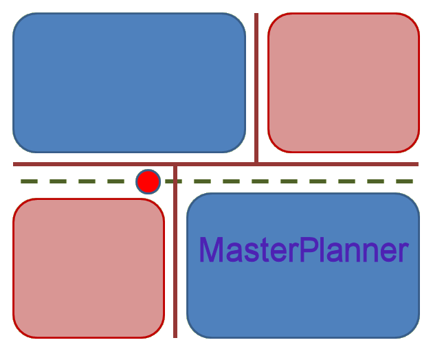
MasterPlanner exists primarily to help you annotate area objects. Each object should have an ID, which makes it simple to identify in reports and tables. MasterPlanner tags an object with further information stored as Item properties. Further information includes …
- Land Use
- Parcel Type
- Building Density
- No. Buildings
- District
- Area Character
- Tenure
Derived Properties
Some properties you can't change. For example, the area and perimeter metrics are properties of a DGN area element (i.e. shape or complex shape element). You can display those values, but you can't change them. If you modify the shape element using MicroStation's tools, then the derived metric is updated automatically.
Alternative metrics are derived from the DGN element properties. The alternative area property value is derived from the DGN element area property. You can display an alternative area, but you can't change its value.
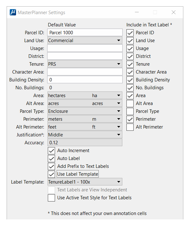
MasterPlanner's Settings dialog provides toggle buttons that let you includes or omit the Land Use and Parcel Type values in a text label.
MasterPlanner Tenure
MasterPlanner District
MasterPlanner Area Character
MasterPlanner's Land Use tag is a text value that you can assign when you tag an area feature. The object's Land Use is arbitrary: you can assign any value you want. Land Use can appear in a report or table. You might want to use Land Use for collating or sorting area tables.
For example, if you are planning a site layout, you may want to designate parcels and other spaces with a Land Use value that is useful. Something like this …
| Land Use | Comment | |
|---|---|---|
| Residential | Land proposed for residential development | |
| Amenity | Land proposed for amenity development | |
| Retail | Land proposed for retail development |
You might create a MicroStation Report that you export to, say, Microsoft Excel®. In Excel you can perform calculations using the above Land Use values. For example, you can calculate the total residential area, or the total retail area by selecting only those areas having a particular Land Use.
They key-in to update the Land Use on multiple elements simultaneously is
MPLAN TAG PROPERTY property-name, new-value
Where new-value is one of the acceptable values for this property.
For example, suppose that you have place a fence around a number of DGN shapes that represent land parcels.
You can re-label those shapes in one shot with the key-in …
MPLAN TAG PROPERTY Land Use, Residential
This command will operate on a single element — just pick an element in the usual way. It's more useful, however, when tagging multiple elements in a selection set or fence.
See the MasterPlanner commands page for information about a specific command.
Building Density
The Building Density is a number that you provide. Building Density might be, for example, the number of residential buildings per hectare in your proposal.
You are in control of Building Density: MasterPlanner uses it only to calculate the potential Number of Buildings in a parcel.
No. of Buildings
The Number of Buildings is a calculated value. It's the Building Density multiplied by the area of the land parcel you are tagging or editing.
You are in control of No. of Buildings: MasterPlanner uses Building Density and the tagged shape's area to calculate the potential No. of Buildings in a parcel.
MasterPlanner Parcel Type
MasterPlanner's Parcel Type tag is a text value that you can assign when you tag an area feature. It is restricted to a small number of values defined by a Picklist. Parcel Type values are currently limited to …
- Enclosure
- Void
You might create a MicroStation Report that you export to, say, Excel. In Excel you can perform calculations using the above Parcel Type values. For example, suppose you have a site plan that shows a large area that encloses a number of other parcels. The Parcel Type of the large area is Enclosure; The Parcel Type of each small parcel is Void. You can perform a net area calculation by subtracting each Void area from the Enclosure area.
They key-in to update the Parcel Type on multiple elements simultaneously is
MPLAN TAG PROPERTY Parcel Type, Enclosure|Void
Where Enclosure|Void means you choose one of the options Enclosure or Void.
This command will operate on a single element — just pick an element in the usual way. It's more useful, however, when tagging multiple elements in a selection set or fence.
See the MasterPlanner commands page for information about a specific command.
Pick Lists
Pick Lists are a list of pre-defined values that may be assigned to a property. For example, Pick Lists are used by MasterPlanner for properties …
- Land Use
- Permitted values are …
- Residential
- Neighbourhood Centre
- Primary School
- Secondary School
- Employment
- Leisure
- Amenity
- Parcel Type
- Permitted values are Enclosure and Void
Custom Pick Lists
If you don't want the Pick Lists provided by LA Solutions, you can supply your own. Pick Lists have been a part of MicroStation CONNECT since Update 10. If you would like to know more about custom Pick Lists, please contact LA Solutions.
Creating Named Groups
MasterPlanner lets you create a MicroStation Named Group from DGN elements having common property values. Elements in a Named Group can be manipulated in various ways using MicroStation's built-in tools.
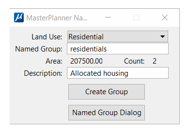
For example, you may have several parcels tagged with MasterPlanner property Amenity. MasterPlanner's group command pops a dialog where you can choose to add parcels with that property to a MicroStation Named Group.
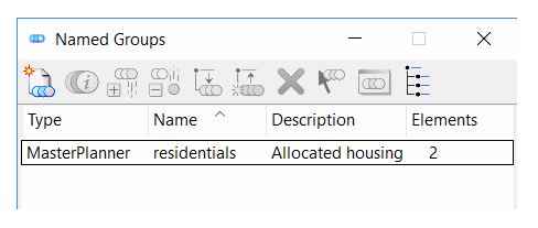
Named Groups that you create with MasterPlanner appear in MicroStation's Named Groups dialog. Each Named Group can be manipulated using MicroStation's tools. For example, you can highlight a Named Group to locate its members more easily. The following screenshot shows MicroStation's Named Groups dialog with some Named Groups created by MasterPlanner …
Tagging Multiple Elements
MasterPlanner lets you tag multiple elements on a named level.
They key-in to annotate multiple elements simultaneously is
MPLAN TAG MULTI DIALOG
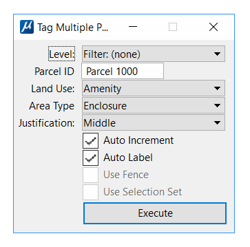
Choose a valid level name and set the initial ID, Auto-Increment and Land Use values. Press the Execute button. MasterPlanner searches for valid elements on the named level, then tags and labels each one.
See the MasterPlanner commands page for information about a specific command.
Return to the MasterPlanner main page
Return to the MasterPlanner main page.
